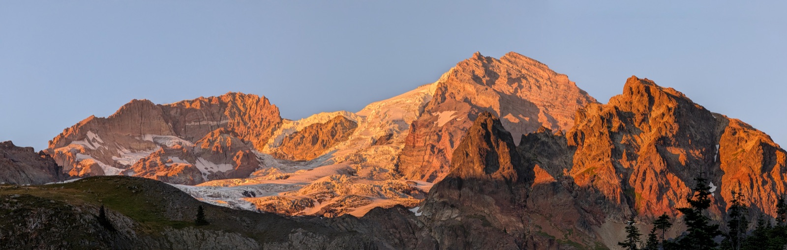
Mount Hood above alpine terrain on the Timberline Trail loop
Volcanic loop classic

Timberline Trail

Mount Hood WildernessVery strenuousUpdated May 2026
Best window
Late July - September
Booking opens
Wilderness permit rules are managed by USFS (verify current season guidance)
Distance (elevation)
39.7 mi
13,928 ft gain / 13,927 ft loss
Typical days
2-5 days
Trailhead
Timberline Lodge
Overview

The Timberline Trail is Mount Hood's full circumnavigation: a near-40-mile loop of glacial river crossings, pumice traverses, and high alpine benches that rewards strong pacing and weather discipline.

How to book

Booking the Timberline Trail

The Timberline Trail is operationally constrained more by seasonal snow, creek crossing conditions, and current wilderness rules than by one fixed quota workflow. Treat this planner as route structure, then verify current permit and registration requirements directly with Mount Hood National Forest.

  • Crossing conditions at Eliot, Coe, Sandy, and White River drainages can change quickly after heat or storms.
  • Early-season snow and late-season smoke are often bigger trip shapers than pure mileage fitness.
  • Timberline Lodge parking and overnight logistics can be busy on prime weekends.
Getting there & finishing

Access, transport, and finish logistics

Start

Most parties start and finish at Timberline Lodge, where services and parking make loop logistics straightforward.

Finish

The route returns to Timberline Lodge after a full circumnavigation. Build margin for slower-than-planned crossing and sidehill sections.

  • No shuttle is required for the standard loop start/finish at Timberline Lodge.
  • Carry a weather-aware plan: storms and heat spikes can rapidly change river crossing risk.
  • Water is frequent but silty in glacial drainages, so filtration and backup treatment both matter.

Route map

Difficulty & terrain

How hard is the Timberline Trail?

  • The physical challenge is cumulative: nearly 40 miles with repeated steep descents and climbs between drainages.
  • River crossings can be the real crux, especially on warm afternoons when snowmelt peaks.
  • Even strong hikers lose time on sidehill traverses and loose volcanic tread, so pace conservatively.
Recommended gear

What to carry for this route

  • Stable river-crossing footwear and poles
  • Warm shell layers
    high alpine weather can swing quickly even in summer
  • Reliable water treatment
    glacial silt can clog filters; bring a backup method
  • Navigation backup + offline map
    visibility can collapse in fog or smoke
  • Camp flexibility
    build margin in case a planned drainage crossing is delayed
Planning notes

Route notes

Route shape

A full volcano circuit with real day-to-day consequences.

Timberline is not a single sustained climb. It is a repeating rhythm of dropping into major drainages, making crossings, then clawing back to high shoulders with huge Hood views. That pattern is what makes the loop both iconic and punishing over multiple days.

This planner keeps the route anchored to trustworthy geometry and camps that are actually useful as overnight decisions, rather than abstract evenly spaced mileposts.

  • South and west sections move quickly but still hide meaningful elevation cost.
  • North-side stages around Elk Cove and Cloud Cap are scenic but not automatically easier.
  • Late-loop fatigue plus White River exposure is where many schedules slip.
Staging strategy

Pick anchors that match your crossing window, not just your spreadsheet.

Two-day itineraries are possible for very strong parties, but most backpackers have a better trip in three to five days with room to adapt. The camp anchors here are intentionally practical: they keep each day believable while leaving room to adjust for heat, smoke, or creek flow.

Clockwise is common from Timberline Lodge, but counterclockwise can be smarter depending on forecast and where you want your biggest crossing decisions to land.

  • Use Paradise or Ramona as west-side setup nights.
  • Elk Cove and Cloud Cap are strong north and northeast control points.
  • White River is a useful final-night anchor before climbing back to Timberline Lodge.
Trip FAQ

Common planning questions

Is Timberline better clockwise or counterclockwise?

Both are viable. Clockwise is common from Timberline Lodge, but direction should follow current crossing conditions, forecast, and where you want your hardest day to land.

Can I realistically do Timberline in two days?

Yes for very strong, efficient parties, but most backpackers have a better and safer trip with three to five days, especially when river crossings or weather are uncertain.

Route references

Related routes

Similar trips to plan next

Planning estimates only. Verify permits, camps, maps, trail conditions, weather, and closures with official sources before travel.